
 Water
Water
Groundwater is considered the major portion of the world’s freshwater resources. With the advance in space technology, it is now possible to employ remote sensing techniques for estimating surface and subsurface water over large areas and Integrated remote sensing and GIS are widely used in groundwater mapping and useful data. the results obtained by remote sensing and GIS can be compared with the geophysical results that used to explore, identify and delineate all possible features connected with localization of underground reservoir.
Groundwater aquifers are not just a source of water supply, but also a vast storage facility providing great management flexibility at relatively affordable costs We provide the methods focus on developing remote sensing modeling and GIS-based tools and Geodata products for mapping surface hydrogeological-related parameters of geophysics, geology. vegetation and soil, as well as models for simulating groundwater-surface interactions and it dynamics.
- Digital treatment and analysis of satellite or radar images, by image processing software (Erdas Emagine).
- Geological and hydrogeomorfologi analysis .
- integration of remote sensing data into Geo information systems.
- preparation geo-spatial data and generate maps to locate undergroundwater
- create (Modeling System) for groundwater network.
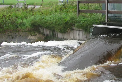
- Reconnect the remote sub- paths and mainstream water basins to rebuild hydrographic networks and follow its course and water flow force in those ponds depending on geological structures and watershed and Watershed slopes and slope to see how water feed in.
Our services in the field of water
rate us
Respect and Integrity Creativity, Innovation Teamwork and Confidence Professionalism
Vision
Our vision is reflected in our constant work to achieve a high-profile position at the forefront of offices specialized in Geographic Information System.
the message
We strive to create a successful and sustainable relationship with its customers by providing expectations
